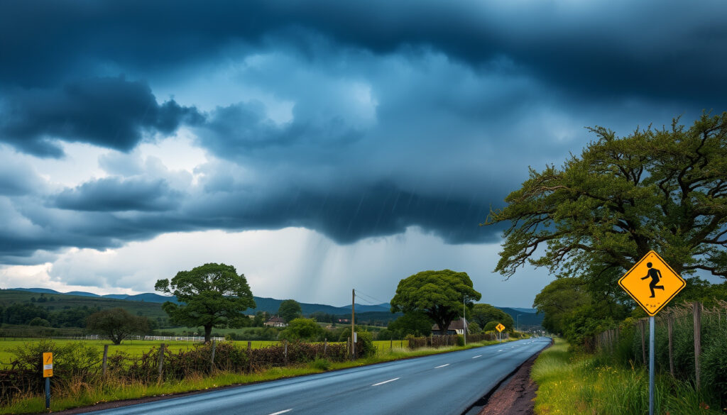
Storm Dave Ireland: Met Éireann’s Status Yellow Wind Warning
There’s something about a named storm arriving on Easter weekend that makes the weather feel personal. Storm Dave, carrying a nationwide Status Yellow warning from Met Éireann, is set to sweep across all counties of Ireland on April 2–3, 2026.
Storm name: Dave · Date: April 2–3, 2026 · Warning level (Ireland): Status Yellow (nationwide) · Warning duration: 2pm to 11pm Saturday · Affected area: All counties of Ireland · Peak wind gusts (estimated): 80–100 km/h
Quick snapshot
- Met Éireann issued a nationwide Status Yellow wind warning valid from 2pm to 11pm Saturday (RTÉ News).
- Warning later extended to 2am Sunday (The Irish Times).
- Strong southerly winds veering westerly by evening (RTÉ News). (RTÉ News)
- Exact locations of worst gusts – localized wind patterns remain uncertain (BBC News).
- Whether Storm Dave will be followed by another named storm in the near term (Met Office Blog).
- Warning issued morning of April 2, active 2pm–11pm Saturday, extended to 2am Sunday (RTÉ News).
- Status Orange for Wexford expired by 9pm (RTÉ News). (RTÉ News)
- Storm clears April 3; post-storm damage assessment begins (The Irish Times).
- No immediate named storms expected after Dave, but long-range forecast uncertain (The Irish Times). (The Irish Times)
Six facts that tell the story of Storm Dave at a glance: from the warning’s timing to the areas affected and the strength of the winds expected.
| Fact | Details |
|---|---|
| Storm name | Dave |
| Date | April 2–3, 2026 |
| Warning level (Ireland) | Status Yellow (nationwide) |
| Warning duration | 2pm to 11pm Saturday |
| Affected area | All counties of Ireland |
| Peak wind gusts (estimated) | 80–100 km/h |
Where is the storm Dave going to hit?
Storm Dave’s track has been well mapped by forecasters, but the localized intensity remains a question mark. Met Éireann warned of very strong southerly winds veering westerly by evening, with severe gusts and coastal gales affecting the entire country (RTÉ News (Ireland’s public service broadcaster)). The storm is coming in from the Atlantic, according to Met Éireann (The Irish Times (leading Irish news outlet)).
Where will Storm Dave be the worst?
- All counties are under a Status Yellow warning, but gusts could be stronger in coastal and exposed areas.
- Wexford received a separate Status Orange warning that expired at 9pm (RTÉ News).
- Northern Ireland counties (Antrim, Armagh, Down, Fermanagh, Tyrone, Derry) have a separate yellow wind warning from the UK Met Office (BBC Weather).
What areas are under warning?
Met Éireann’s blanket yellow warning covers every county in the Republic of Ireland. The UK Met Office issued a matching yellow wind warning for Northern Ireland, in effect from 2pm Saturday to 3am Sunday (BBC Weather). Bottom line: No part of the island avoids the storm, but the highest risk of damage concentrates in southern and western coastal counties.
For a holiday weekend, even a yellow warning can disrupt travel and outdoor plans. With gusts reaching highway speeds, motorists in exposed areas face a real risk of being hit by falling debris.
The implication: even with a blanket yellow warning, the storm’s impact varied significantly based on local geography and the short-lived Orange warning for Wexford.
What warning is storm dave?
Met Éireann issued a nationwide Status Yellow wind warning for Storm Dave, initially valid from 2pm to 11pm Saturday and later extended to 2am Sunday (The Irish Times (Ireland’s newspaper of record)). The UK Met Office named Dave, while Met Éireann uses its own warning colour system — they don’t officially adopt the storm names from the UK.
What does a Status Yellow wind warning mean?
A yellow warning signifies strong to gale-force winds that can create hazardous driving conditions and cause damage from very strong gusts (BBC News). The warning’s impacts include fallen trees, branches, wave overtopping, difficult travelling conditions, and displaced debris or loose objects (RTÉ News). Coastal flooding is also likely because of heavy rain and high tides (The Irish Times).
How does the warning compare to amber warnings?
Amber (Status Orange) warnings indicate a higher impact level — Met Éireann issued a short-lived Orange warning for Wexford earlier in the evening, which expired at 9pm (RTÉ News). While yellow means “be aware,” orange means “be prepared” for significant disruption.
A yellow warning covers everyone but tells nobody exactly how bad it will get in their neighbourhood. Localized gusts can turn a yellow event into a damaging one, especially near the coast.
The implication is that yellow warnings require individual vigilance, as the difference between a manageable storm and a damaging one often comes down to hyperlocal wind behaviour.
Is there another storm coming to Ireland?
As of April 3, no immediate named storms are expected after Storm Dave clears. The long-range forecast from Met Éireann extends to 15 days but does not indicate another storm track for the remainder of Easter week (Met Éireann). Summer 2026 outlook remains uncertain, with no official heatwave warnings currently in place.
What is the long-range forecast for Ireland?
Met Éireann provides 7-day and 15-day forecasts, but storm predictions beyond a few days are unreliable. The UK Met Office summarised Storm Dave as affecting the UK during 4–5 April 2026 (Met Office Blog (UK’s national weather service)). For Ireland, the immediate risk is the post-storm clean-up, not a second system.
How does Storm Dave relate to upcoming weather patterns?
Storm Dave fits into a spring pattern where Atlantic lows can still pack a punch. The contrast with the ongoing heatwave discourse — Ireland’s summer heatwaves are often compared to 1976 — highlights how variable Irish weather can be. No summer forecast has been issued yet, and the Easter storm does not itself predict a hot summer.
The catch: while no immediate storms are on the horizon, the long-range forecast remains too uncertain to rule out further severe weather before the end of spring.
Timeline: Storm Dave’s path
The storm progressed through a clear sequence of events. Here’s how it unfolded.
- April 2, 2026 (morning): Met Éireann issues Status Yellow wind warning for Storm Dave.
- April 2, 2026 (2pm): Warning begins; strong winds start affecting Ireland.
- April 2, 2026 (evening): Winds peak; potential for fallen trees and coastal overtopping. Wexford gets an Orange warning that expires at 9pm.
- April 2, 2026 (11pm): Initial warning expires, but Met Éireann extends to 2am Sunday.
- April 3, 2026: Storm Dave clears; post-storm assessment begins. An estimated 18,000 homes, farms and businesses are left without power (RTÉ News).
Clarity report: Confirmed vs unclear
Confirmed facts
- Status Yellow wind warning for all Ireland from 2pm to 11pm Saturday (later extended to 2am Sunday) (RTÉ News).
- Storm Dave named by UK Met Office (The Irish Times).
- Strong southerly winds veering westerly by evening (RTÉ News).
- Around 18,000 homes, farms and businesses lost power (RTÉ News).
- A separate yellow wind warning was in effect for Northern Ireland from 2pm to 3am Sunday (BBC Weather).
What’s unclear
- Exact locations of worst impacts (localized gusts) (BBC News).
- Whether Storm Dave will be followed by another named storm (Met Office Blog).
- The full extent of damage — post-storm assessment ongoing (The Irish Times).
- Exact duration of peak winds in specific locations.
- Long-term economic impact of the storm.
Expert perspectives
The yellow warning covers the entire country with very strong southerly winds veering westerly by evening, bringing severe gusts and coastal gales.
Met Éireann forecaster (official warning statement, RTÉ News)
Around 18,000 homes, farms and businesses are without power as a result of Storm Dave, with the storm now clearing eastwards.
RTE weather correspondent (live update, RTÉ News)
For those in the path of the storm, the priority is safety: stay indoors during peak gusts, secure loose objects, and check on neighbours, especially the elderly. For businesses and local authorities, the clean-up and power restoration will be the focus through Sunday (Gov.ie Emergency Info).
irishtimes.com, severe-weather.eu, metoffice.gov.uk, facebook.com, facebook.com, youtube.com, met.ie, youtube.com
For a detailed account of the power outages and flight disruptions, see our Storm Dave Ireland coverage.
Frequently asked questions
How is Storm Dave named?
Storm Dave was named by the UK Met Office as part of its storm-naming system. Met Éireann does not officially adopt UK storm names, but the name is widely used in media.
Should I travel during the warning?
Not if you can avoid it. The warning period (2pm Saturday to 2am Sunday) is the most dangerous for driving due to strong gusts, fallen branches, and reduced visibility.
Will flights be affected?
Possibly. Strong crosswinds can delay or cancel flights. Check with airlines and Dublin Airport, Shannon, and Cork for real-time updates.
How long will the strong winds last?
The strongest winds are expected between 2pm and 11pm Saturday, with conditions easing after midnight Sunday.
What should I do to secure my property?
Bring in garden furniture, secure bins, close and lock windows and doors, park vehicles away from trees if possible.
Is Storm Dave related to climate change?
Attribution of a single storm to climate change requires detailed analysis. However, warmer Atlantic waters can increase storm intensity. Climate change is expected to bring more frequent extreme rainfall events to Ireland.
For residents and business owners in Ireland, the choices are clear: take the yellow warning seriously, defer non-essential travel during the peak, and prepare for possible power outages. The Easter weekend might be disrupted, but a little preparation now can prevent much bigger problems later. If you haven’t already, read our Emergency Preparation Booklet Ireland for detailed steps on storm readiness. For those travelling, also check the Canary Islands Weather Warning if you’re heading that way.
More related posts
 Brasileirão Série A Statistics 2026: Top Scorers & Table
 Galaxy M32 to Buy – Current Prices and Availability in India
 How to Make Scones: Simple Step-by-Step Recipe
 Roe and Co Whiskey: Dublin’s Modern Blended Irish Whiskey
 Snatch: Brad Pitt’s Age, Transformation & Diagnosis
 Pat Kenny Signs Off: Weekday Show Ends, Weekend Role Begins
 Trucks for Sale Ireland: DoneDeal, Autoline & More
 What Foods Are High in Fibre? Top Sources & Daily Needs