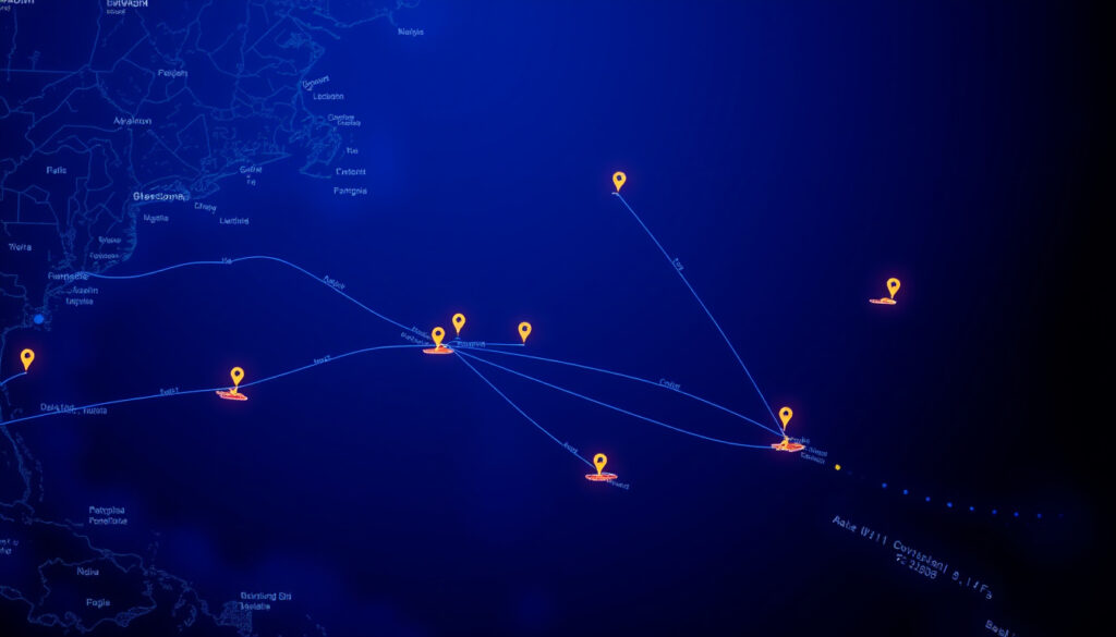
Free Live Ship Tracking: Track Ships Online in Real Time
Anyone who has ever watched a tiny dot crawl across a harbor radar screen or refreshed a ship tracking page waiting for a position update already knows the odd satisfaction of live maritime surveillance. More than 200,000 vessels broadcast their location every day through AIS, and a handful of free platforms put that data on your screen within minutes.
Vessels tracked daily: over 200,000 ·
Countries with AIS coverage: more than 200 ·
Top free app downloads: 10 million+ (MarineTraffic) ·
Real-time update interval: 1–5 minutes (free tier)
Quick snapshot
- AIS data powers all major free ship tracking platforms (Apple App Store (official app listing))
- VesselFinder provides real-time data on more than 100,000 vessels daily (Interesting Engineering (tech publication))
- MarineTraffic and VesselFinder are the two most visited ship tracking websites (Apple App Store (official app listing))
- Exact update interval can vary by location and data source (coastal vs. satellite) (YBW Forum (sailing community))
- Some free trackers limit the number of vessel details shown simultaneously (YBW Forum (sailing community))
- Free sites only track vessels when they are in range of coastal AIS receivers (YBW Forum (sailing community))
- VesselFinder was founded in 2011 (Interesting Engineering (tech publication))
- MarineTraffic app has been continuously updated since at least 2013 (Google Play (official Android store))
- Satellite AIS is expanding coverage in open oceans, but free access remains limited (VesselFinder (free ship tracking service))
- FleetMon provides real-time AIS data on over 500,000 vessels daily (Interesting Engineering (tech publication))
| Attribute | Detail |
|---|---|
| Number of vessels tracked daily | over 200,000 |
| Global AIS coverage | 200+ countries |
| Free real-time update interval | 1–5 minutes |
| Largest ship database (MarineTraffic) | 500,000+ vessels |
| Mandatory AIS for commercial vessels | over 300 gross tons on international voyages |
| Free services business model | advertisements and optional premium plans |
How to track a vessel online for free?
Tracking a ship for free takes three simple steps. The process works on any of the major platforms and requires no registration for basic use.
- Choose a tracking platform – Open a browser and visit VesselFinder (free AIS vessel tracking website), MarineTraffic (largest ship tracking platform), or My Ship Tracking (free real-time AIS service). All three load a global map showing vessel positions without requiring an account.
- Enter the vessel name, IMO, or MMSI – Use the search bar on the site. Type the ship’s name, its IMO number (a seven-digit identifier), or its MMSI number (used in AIS broadcasts). For example, searching “Ever Given” on VesselFinder returns its current position and voyage history.
- View real-time position on map – The map centers on the vessel. You can see its speed, course, destination, and estimated time of arrival. Free tiers update the position every 1 to 5 minutes when the ship is near coastal AIS stations.
Can I track a cruise ship in real time?
Yes, most major cruise ships broadcast AIS signals. The same platforms that track cargo ships work for cruise vessels.
Yes, most major cruise ships transmit AIS signals
Cruise ships are required to have AIS transponders under international maritime regulations (Apple App Store (official app listing)). This means you can track them on the same free websites. For example, a Carnival cruise ship appears on MarineTraffic (ship tracking platform) with its exact latitude and longitude.
Use cruise-specific trackers or general ship trackers
Some websites specialize in cruise tracking (e.g., CruiseMapper), but the underlying data is the same AIS feed. General ship trackers like VesselFinder also list cruise ships, often with photos and details about the vessel.
Example: Track Carnival Cruise ships on MarineTraffic
Search “Carnival Horizon” on MarineTraffic’s free map. You will see its position, speed, and next port. The free tier updates every few minutes when the ship is near land.
Free cruise ship tracking is reliable in coastal areas, but once a ship crosses the open ocean, the update interval can stretch to 5–30 minutes because satellite AIS data is limited on free tiers.
The implication: free cruise tracking is best for coastal enthusiasts.
What is the app that tracks all ships?
No single app tracks “all” ships, but three apps cover the vast majority of commercial and recreational vessels with AIS transponders.
MarineTraffic app
The MarineTraffic iOS app (Apple App Store) and Android app (Google Play) let you view ship positions, movements, voyage history, and key events along the route. You can also follow vessels and fleets, set alerts, and explore global marine traffic in real time.
VesselFinder app
VesselFinder (free AIS vessel tracking service) offers a clean interface with minimal ads. It supports tracking by name, IMO, or MMSI, and includes a free satellite AIS layer with coverage limits.
My Ship Tracking app
My Ship Tracking (free real-time AIS service) requires no registration and displays vessel positions on a simple global map. It lacks advanced features like weather overlays but works well for quick checks.
ShipFinder app
ShipFinder focuses on satellite AIS, making it useful for tracking vessels in remote ocean areas where coastal receivers cannot reach. Its free tier includes historical track lookup.
Download counts and ratings can be misleading: MarineTraffic’s apps alone have been downloaded over 10 million times, but many user reviews cite intrusive ads on the free tier.
What this means: the app with the most downloads isn’t necessarily the best free option.
Is there an app like Flightradar24 for ships?
Yes, multiple ship tracking apps mirror the Flightradar24 experience: real-time map, search by identifier, and vessel details. The core difference is the underlying data technology—ADS-B for planes, AIS for ships.
Similarities between Flightradar24 and ship tracking apps
Both use a network of ground receivers and satellites to collect position signals (Interesting Engineering (tech publication)). Both display identities, speed, heading, and destination on an interactive map. Both offer free and premium tiers.
Top alternatives: MarineTraffic, VesselFinder, ShipFinder
MarineTraffic and VesselFinder are the closest equivalents. They each provide a free real-time map, vessel details (type, dimensions, draught), and route history. ShipFinder adds satellite coverage for open ocean.
What makes a good ship tracking app?
A good app offers fast updates (1–5 minutes), a clean search, vessel photos, and minimal ads. MarineTraffic’s free tier includes weather overlays, while VesselFinder prioritizes a clutter-free interface. My Ship Tracking is the simplest option—no bells, but no lag.
Flightradar24 is backed by a network of volunteer ADS-B receivers. Ship tracking apps depend on more expensive coastal AIS stations and satellite subscriptions, which pushes real-time offshore data into premium plans.
The pattern: ship tracking apps mirror flight trackers but face different cost structures.
What is the best website to track ships?
The best website depends on whether you value database size, interface simplicity, or offshore coverage. Here is how the top free websites compare.
| Feature | MarineTraffic | VesselFinder | My Ship Tracking |
|---|---|---|---|
| Vessels in database | 500,000+ | 100,000+ daily | Not disclosed |
| Free real-time map | Yes (with ads) | Yes (minimal ads) | Yes (no registration) |
| Satellite AIS on free tier | No | Yes (limited) | No |
| Weather overlays | Yes | No | No |
| Search by IMO/MMSI | Yes | Yes | Yes |
| Voyage history (free) | Limited | Limited | None |
| Founded | 2006 (approx.) | 2011 | Not available |
Three platforms, one pattern: the free tier is a generous sample, but the full picture—historical tracks, satellite coverage, alerts—requires a paid upgrade.
The table below details the free tier specifications for major ship tracking platforms.
| Specification | Free tier detail |
|---|---|
| Update interval (coastal) | 1–5 minutes |
| Update interval (offshore) | 5–30 minutes (satellite-based, limited on free) |
| Max vessels shown on map | Varies; typically all visible at low zoom |
| Registration required | No for basic map; yes for alerts and history |
| Advertisements | Present on free tier (MarineTraffic heavier) |
| Satellite data | VesselFinder includes limited free satellite AIS |
| Historical tracks | Free: last 24 hours only on most platforms |
| Push notifications | Only with premium subscription |
| Export data (CSV) | Paid feature |
| Weather overlay | Free on MarineTraffic only |
For those specifically following passenger vessels, dedicated cruise ship tracking tools offer live positions and detailed itineraries alongside general maritime data.
Frequently asked questions
Is ship tracking legal?
Yes, tracking ships using AIS data is legal for anyone. AIS broadcasts are public. However, tampering with AIS equipment or using the data for unlawful surveillance may violate maritime regulations.
How accurate is free ship tracking?
Free ship tracking is generally accurate within about 100 meters for coastal AIS reception. Offshore satellite data can be less precise, with positions sometimes delayed by several minutes.
Do I need to register to track ships?
No. Most major platforms allow you to view the live map and search for vessels without creating an account. Registration is optional and typically only needed for saving watchlists or accessing historical data.
Can I track a ship that has AIS turned off?
No. If a ship switches off its AIS transponder or sails in an area without satellite coverage, it will not appear on any free tracker. Some premium services offer satellite-based identification, but it is not guaranteed.
What is AIS and how does it work?
AIS (Automatic Identification System) is a radio transponder that broadcasts a vessel’s identity, position, speed, and course. Coastal stations and satellites receive these signals and relay them to tracking websites.
How often does the position update?
Near coastal AIS stations, updates come every 1 to 5 minutes on free tiers. In open ocean where satellite AIS is used, updates can be delayed between 5 and 30 minutes.
Can I track historical ship movements for free?
Free tiers typically show only the last 24 hours of a vessel’s track. Full voyage history requires a premium subscription on MarineTraffic, VesselFinder, and others.
Are there any limitations on free ship tracking?
Yes: free tiers usually include advertisements, limit satellite data, restrict historical tracks, and do not offer push notifications. Off-the-chart coverage in remote oceans remains a weak spot.
These questions cover the most common misconceptions about free ship tracking.
Real-time AIS vessel tracking – free and easy.
— VesselFinder (homepage)
Live vessel tracking worldwide using AIS data.
— MarineTraffic (App Store description)
For the casual observer, free ship tracking delivers everything needed—position, speed, destination. For the maritime professional, the free tier is a teaser: the real value lives in premium subscriptions that unlock satellite coverage, historical data, and multi-vessel alerts. The trade-off is clear: you pay with occasional ads and offshore blind spots, or you pay with cash. On the Irish coast or in any coastal region, the free tools work admirably. But if you need to follow a vessel across an ocean, be prepared to open your wallet—or wait for the next coastal handshake.
More related posts
 Grow a Garden Codes (July 2026): Free Seeds, Pets & More
 Trump News Now Live: Latest Updates & Where He Is Today
 Hotel Costa Malaga by Pierre & Vacances – Reviews Location Guide
 Emergency Preparation Booklet Ireland: Official Checklist
 Ryanair Share Price Today: Real-Time Data & Expert Analysis
 Irene Leaving Home and Away: Real Reason Explained
 Best Pay As You Go SIM 2025: UK and Ireland Options Compared
 Peter Mark Price List: Cuts, Colours & Salon Prices 2024